Sunday, 28 August 2016

Lago Verde to Palena along the Ruta Patrimonial and on to Futaleufu

Leaving Lago Verde
We soon learned there was a trail called the 'Ruta Patrimonial' between the two towns.  We headed out of Lago Verde and followed our gaucho directions to the end of the road, running into a couple other farmers along the way, who generously shared a bit of their time with us, as well as some more information on the route.

Trail Marker
Another Trail Marker
We soon discovered the road turned into a faint two-track and then turned into a horse trail and sometimes disappeared all together, but we found our way without much difficulty. At this point, we were able to realize more quickly if we had taken a wrong turn, and I always had one eye on my compass. There was a bonus to this trail- we found wooden placards every once in a while with a number order to them, so we were able to count down the placards towards Palena. The country had at one point put some money into this trail, though it seemed as though the funding had run out recently because it was overgrown in some spots. A trail is a trail, and we were grateful. We wound up and then down a valley, crossed a few streams, and were into the next valley before our second night.

Beautiful water source
Morning stream crossing-BRRRR
As we followed the trail along the next morning, we noticed there was quite a bit of smoke in the valley, and it smelled strongly of wood smoke. We kept an eye out for flames, but didn't see any. The smoke persisted throughout the day into the night, and we camped in a smokey valley. I woke up with a sore throat. We lost the trail that day, though every once in a while we would come upon a numbered marker, so we knew we were going the correct direction. As we neared Palena, we ran into a man on horseback (per usual), and he told us about the fire burning outside of town. As usual, life was going on without much concern for the wall of smoke and ash, though with this fire, there was a helicopter dropping water from a nearby river on it. It was an amazing sight- since in the U.S., they would never let a lay person that close to a wild fire, and to be walking towards it for days without any concern was eye-opening. We camped in an abandoned field outside of Palena that night, watching the fire burn on the hillside downwind from us, glowing eerily in the distance as the sun set.

Fidgit and I walked into Palena the next morning and were able to do another in-and-out-of-a-town in one day! We also were able to eat a (metric) ton of empanadas, and they were delicious. As we road walked out of Palena, everyone seemed quite nice and were able to direct us along the way.
Smoke along the Ruta- campfire smell permeates all

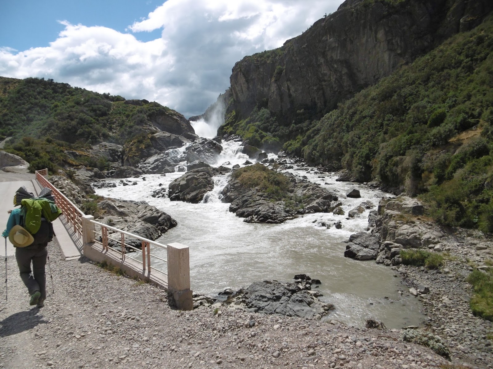
We decided to road walk to Futaleufu because our other options were not ideal. The decision was a tough one, as we have both come to the conclusion that road walking is horrible, and we wouldn't do it if other, more viable options existed. We made the most of our trek along the dirt road, taking photos, snacking, chatting, sing alongs, pretending to be chased by cattle, and of course, laughing at ourselves. We even took advantage of a well-deserved opportunity to swim on a particularly hot day. In a couple of days, some of which seemed unending, we were all of a sudden in 'Futa', as the locals call it.
Another COLD river crossing

Found the source of the smoke

EMPANADAS. and Fanta.
Road Walking
Cattle Herder and his herd

Rio Futaleufu, from our campsite

Rio Futaleufu and I

Sunday, 21 August 2016

La Tapera to Lago Verde

Fall is creeping up on us!
We resupplied in Villa La Tapera quickly, as we didn't need much to make it to Lago Verde, and we then hung out in the Plaza de Armas, checking our email and catching up with cohorts back home. Chile seems to be taking an initiative to equip these tiny little border towns with public WiFi, and we're not complaining.

Lovely campsite for the night with a lovely view
Fidgit and I left town in the late afternoon, hoping to get a few more kilometers in for the day. We had been noticing the sunlight no longer stretched late into the evening, and we wanted to be able to find a nice spot to camp before the natural light went out on us. We crossed Rio Cisnes and stopped by to get some more directions from the estancia across the River. The husband and wife were both quite kind, though distracted as apparently their whole family was coming in for a week, and they were preparing. We stayed for a short bit, and they - of course - shared what they were preparing with us, as well as information about the way to Lago Verde. We parted ways and walked down the quiet two track into the rolling hills yet again.

Gotta love the signage here, when it exists
Coming down into Lago Verde's valley
We were following a little-used road to Lago Verde, which usually made for easy route finding, though there were a few kerfuffles where equally-as-used roads would veer off in a direction we were unsure of. When I say little-used, I mean by vehicles- we saw a few men on horseback followed by their pack of dogs that every gaucho seems to have. By this point in our travels, we had learned to always double check if unsure, or it could mean hours of back-tracking (yes, we learned this the hard way). The route is a beautiful walk through some pristine woodland with multiple water sources along the way, because you basically follow one stream up the valley then cross down into another valley, walk along a river and up another valley, then follow that down into Lago Verde. This last valley  near Lago Verde was quite smokey, and we discovered a forest fire was burning, mostly in Argentina just east of the town. No one seemed concerned; a couple people we talked to just said nonchalantly that we probably wouldn't be able to go over to Argentina (which we weren't planning to do). I found this interesting, because I was worried that the town would be evacuated,  and we wouldn't be able to resupply. Nope. Apparently it's just the U.S.  that reacts to uncontrolled forest fires that way. We walked right into town, and the only reason people were surprised was because of the way we had come in- on foot.

Fidgit taking some time to play her uke at camp
Lago Verde was an unexpected multi-day stop, but mostly because the town was so tiny we had trouble getting our town chores done in a timely manner. We are slowly adapting to this South American way of slowing down, though it is sometimes frustrating to not get direct answers. We did glean enough information to be able to follow a trail to Palena, which was very exciting news.
Forest Fire smoke as we near Lago Verde

Made it to town!

Sunday, 14 August 2016

Coyhaique and on to Villa La Tapera

La familia en Coyhaique
Coyhaique may have been a respite for us, but we were not fully resting- I've found there has to be a balance of resting with socializing. Thankfully the non-resting was also enjoyable and we got to meet and talk to multiple people who were helpful and insightful. We stayed at (you guessed it) a friend of a friend's house, and she couldn't have been a more gracious and wonderful hostess. Sandra not only shared her home, she also shared her beautiful art pieces and life's story with us, helping us learn more about the Sin Represas movement and how many people in the area are trying (with some success) to keep Patagonia's river ways flowing free and wild.

Sin Represas HQ
We integrated into the family quickly, enjoying Cassandra's cooking and Francisco's stories from work, talking about life in general. We stayed longer than planned, but in the end had to keep moving after a whopping 6 days off. We didn't say goodbye because Sandra doesn't like them, though received a heartfelt note from her instead. As we wandered out of town, I was sad to be leaving the lovely family we had come to know but happy to be moving again.

Looking back on Coyhaique
Reserva Nacional Coyhaique
Giant trees in the Reserva
We got to stretch our legs for a bit walking across town, and then pushed uphill in the direction of Reserva Nacional Coyhaique. The reserve is right outside of town, and the young woman at the entrance station was concerned with our questions about how to get out of the reserve on the other side. We talked with her for a bit and then, convincing her that we would do the loop she strongly suggested, walked a few kilometers into the park and found a lovely little area to camp alongside a small pond. We looked at some maps that evening and discussed our options. The next morning, we headed further up the trail, bushwhacked a bit across to the reserve's edge, and promptly continued north along an old dirt track that we found. It is a struggle for the people in the parks to understand what we are doing, and they always want us to go on a loop hike, so sometimes we have to deceive to be able to continue walking not on roads. It's unfortunate, though with the lack of a trail/accountability system in Chile it hasn't been too much of an issue yet. As we continue north, we came upon a police estancia, and they came out-surprised to see us coming in from their back fields. We asked them if we can go to the road, and they allowed us to pass through.

Walking along two-track
We took a break at the road to discuss our options to move on, not wanting to push our luck much further. We decided to stick to the road for a bit and then turned off onto a two track dirt road that immediately went down across a stream and back up a steep grade for a couple miles. We went up and up, then the road plateaued and we wandered across open fields to where the road ended at someone's home. After talking with the home owner, he offered us a track to a town directly east of us, not in the direction we wanted to go. We decided to back track a bit though, to another two track ending and then hop across a couple of fields to another two track which eventually led us in the direction we wanted- north! Thank goodness for GPS and some decent maps for this section. After scaring some cows, a good night's sleep, and being admonished by another local as we made our way down his driveway, we made it to another paved road. It had been a tough stretch people-wise, so we were hesitant to follow a route we had found, but decided to go for it, and were not disappointed.

Moises and Fidgit in the morning
We wandered down the driveway of yet another estancia and were greeted by a kind man who offered us a place to sleep as well as some directions the next morning. A lovely way to start a chilly morning is trying to keep up with a former track and field stand-out while carrying a pack, whew! But we made it, and Moises was very helpful in us getting over the pass without many wrong turns.

We walked into Manihuales the next day, ready for some empanadas and cleaner clothes. We found Moises' wife who runs a hospedaje, and she helped us navigate the small town, and invited us over for onces that evening. We left late the next morning filled with food for our horribly long road walk to Villa La Tapera. We usually try to avoid road walks as they have a tendency to make us grumpy, though had to road walk this stretch because it was either that, or illegally cross out of and then back into Chile. We opted to keep it legal. As we wandered along Ruta 7 for multiple days getting passed by multiple vehicles, I day dreamed about what not being on a busy road was like. As per usual in life, the hours passed slowly but soon our road walk was over and we had made it along Rio Cisnes to the lovely and small town of La Tapera.
Looking out at the Andes

Hello? Are we done with this road walk yet?

KM 100 on Ruta 7

Almost to the dirt road to Villa La Tapera

Me and my giant Avocado, we named him Paul.
Road walks can be pretty- Rio Cisnes


Sunday, 31 July 2016

Chile Chico to Coyhaique

We found more Sendero!
Chile Chico was a small town, though we could tell tourism was a large part of the town with many people making the short side trip from the Carretera Austral to visit this port-and-border town.  It was Fidgit's birthday as we came into town, and we were able to get a giant and delicious lunch, so we weren't walking around hungry for too long. We spent the night in a campground right outside of town, resupplied the next day AND were able to find some decent maps of our next stretch of walking going into Coyhaique.  Unfortunately, we were not able to get across Lago General Carrera, so had to spend another night in town.  Thank goodness for wine and good conversation!

Leaving early in the morning, there was a faint chill in the air. The dock was the only place in town abuzz with activity, as we've learned mornings are not something most Chileans do.  Having been up late, I fell asleep for most of the multi-hour boat trip.  I woke up, and we docked and disembarked.  The walk out of town seemed all uphill, and we zig-zagged up a steep dirt road towards Cerro Castillo and its tantalizing mountain views.  After multiple days of road-walking, we were ready to be on-trail again. But first, the road walk.

Sometimes road walks are pretty
We followed Chile's attempt at a trail- the Sendero de Chile (remember that from an earlier post??) for about a day along the road, and then it went off the road!! We were aghast, and followed the Sendero markings down a smaller dirt road, past a fishing resort situated between two lakes.  We stopped at the resort and talked with the chef.  He said we could hang out on their deck for our morning break and was able to give us information on where the Sendero went- turns out it went right into Villa Cerro Castillo!  He also brought out some leftover desserts and yogurts, such a hospitable guy.

'Trail Magic'!
We moved onward to the small town nestled at one of the entrances to Reserva Nacional Cerro Castillo.  Walking into town, we saw many people trying to hitch-hike out of town.  I was glad to not be among the droves trying to get a ride, instead able to rely on myself to get to Coyhaique. We ate a late lunch in the town square and walked into the Reserva. As we were about to head up to the first camp, a horse caravan came down and their guide warned us it was going to be cold and windy at the camp we were planning on going to. After consulting with a few others who had come down the path after the horseman, we heeded his advice and called our day a bit early.

Along the route in Cerro Castillo
Good thing we stayed low, because we had a giant windy climb the next morning up over a pass to a glacial lake where it began raining and stayed windy for our excursion down and up another valley, over a windy exposed pass, then down ANOTHER valley to camp. Thankfully this was on-trail hiking, as Cerro Castillo is a popular trekking loop not far from the Regional Capital of Coyhaique. The weather may have been cold and windy, but my spirits were high, we were on trail in the mountains again!  Having some peanut M&Ms also helped the situation, but the mountains!  Muy Hermoso.

Our helpful Ranger
It was decision time again. We had heard about a route that went more northerly up a valley. The traditional way is to continue following the valley we were already in down to a road and hitch from there. We are obviously not proponents of taking a ride, so we tried to get some information from the park ranger who was conveniently at our camp that night. After an hour and multiple stories, he acquiesced and showed us a Lonely Planet book (in English!) that had a route description. He also warned us that so few people go that way he wasn't sure how the trail would be, as it's no longer kept up by the park service.

Almost to the pass
We left the 'back country' ranger station the next morning, made sure to make the required left across an unkempt bridge, and followed an old dirt road nearly up to the pass. The road petered out and a trail continued up through the forest then across a rocky face to the pass, cairns marking the way. The 'trail' on the other side of the pass was a different story. The cairns ran out just as the alpine meadow did, as we came upon at a thickly forested steep valley leading down to Lago Paloma.  Because of the trees, we could only see the lake on our GPS, so we had to bushwhack down the valley until we got to an area too steep to walk down and went up the valley side. We repeated that a few times, and we popped out on an area that was obviously a giant rock slide. And by giant, I mean the entire right side of the already steep valley was loose dirt and rock.

Looking at Lago Paloma from the landslide area
We carefully picked our way up and across the rock slide area for 3 hours, and came face to face with a steep gully. We butt-slid and dropped from tree-to-tree down the gully and headed back up to finally find a lovely campsite along a small stream near where we thought the trail should be. We both fell into an exhausted sleep after setting up camp, eating dinner, looking at our GPS maps, and getting water.  The next morning, we decided to head uphill from where we camped in search of the trail. Lo and behold, up a drainage about half a mile, a human-built bridge! We were back on the trail and able to follow it down along a few meadows the rest of the morning. We were both so relieved to be on trail that we sang and laughed the rest of the day. At the end of the trail was a road that led to another road that led to another toad that led down towards Lago Paloma and also into Coyhaique. We were nearly to our next town stop!

A BRIDGE!
Road walking is a struggle in itself, but I didn't mind as much as the concern for being lost and on a steep valley side melted away while meandering along the dirt road and was replaced by concern for where we would sleep and get water that night. We walked into Coyhaique in a day and a half, and were overwhelmed- the Capital of the Aysen region was the largest town so far.  There were people everywhere, and some of them were quite talkative. Thankfully we were welcomed with open arms into the home of Sandra and her family and had a wonderful multi-day respite.


Locked gates= no problem for me


Walking into Coyhaique


Wednesday, 27 July 2016

Cochrane to Chile Chico

Lago Cochrane
We came into Cochrane hot and thirsty from the road walk in.  Thankfully, it was another very walker-accessible town, and we were also welcomed by (of course) a friend of a friend who is now our friend.  He allowed us to stay in his yard, which was amazing, as all the fruit on his trees had just ripened and we (especially me) ate our fill. Our host was quite gracious, though requested that we not talk him up too much, so I will only say multiple days of rest, relaxation, and great conversation were had. We did the usual around town things, such as attempting to find maps, figuring out our next section (we actually figured out the next two sections!), eating as much town food as we could stomach, and resupplying.

Walking out of Cochrane, we walked along trails into Reserva Nacional Tomango, which runs along the northern side of Lago Cochrane and is a habitat for the endangered Huemul, a small deer-like animal that is becoming more rare as its habitat becomes smaller.  I had never heard about Huemul before, but everyone knows about them down here, and asks us if we've seen any(we haven't).  It is amazing the number of people who care and know about their surroundings down here.

Looking out on the Welcome Center at Parque Patagonia

As a favor to our host from Cochrane, we stopped by a his friend's Estancia right outside of Tomango to drop off some maps. Unfortunately, he was not there, so we just left a note and camped in his yard for the night, meeting all the chickens and the cat instead.  We walked on the next morning, and into Parque Patagonia. The valley opened up before us, and we curiously wandered to the visitor's center to have lunch on their manicured lawn. The giant stone buildings and the watered lawn with a prop plane sitting on it seemed odd, and I felt out of place sitting in such a lush lawn after spending countless hours among trees, rocks and underbrush.

Our campsite before heading up Valle Chacabuco
Along the Valle
Let me explain: Parque Patagonia is one of Doug and Kris Tompkins' (founder of The North Face and his wife) projects in their beloved Patagonia.  Even after Doug died of Hypothermia in late 2015, his name and legacy have continued in Patagonia. Some people love what they've done with the land they've bought up, some people hate it.  It's always interesting how much more one learns coming into a conversation with an inquisitive mind. 'Why give land back to the government, they'll just ruin it?' 'How can he not have ulterior motives?' 'Why don't people understand that what he's doing is amazing?' Anyway, I had and still have mixed feelings about the Parque and their non-profit Conservacion Patagonica, which is why I was excited that we got to check it out and decide for ourselves what we thought.

Valle Hermoso
From the visitor's center, we made it out to Valle Chacabuco to continue our walk north. There were actual campsites which threw us off, though the bathrooms were not yet functional, so it didn't throw us off as much.  We had met a couple other Americans, and I found it nice to be able to converse in a language I was fluent in as opposed to my usual stumbling Spanish attempts (though I am always grateful for everyone's patience in said attempts). We talked into the evening, and I went to sleep dreaming of the next few days, thinking maybe these guys could keep up.

We were leaving, but I had to get a photo
We ran into some ranchers along the road
I was mistaken, the guys had a more relaxed plan through the valleys. Fidgit and I had planned on taking 3 or 4 days through and ended up cruising the trail, finishing it in 2 days.....I guess that's what happens when you put solid trail in front of thru-hikers. Valles Chacabuco and Hermoso were very beautiful, with older refugios and fun walking. The 10-12 river crossings we did down Valle Hermoso  didn't change my mind. The water was, of course, glacier melt. A fire in the refugio to dry out our clothes was just what we needed, and we had one.  We walked to the Jeinimeni Ranger Station the next afternoon, and lunched under a tree out front. The ranger was so kind, asking us multiple times if we needed/wanted a ride into Chile Chico, telling us how far it was (60km-ish), and attempting to remember the water sources along the way.  We thanked him for his kindness and hit the dusty road with vigor, as Fidgit wanted to see the 'Cuevo de los Manos' he had mentioned was along the way.

Walking the road into Chile Chico was more interesting than the road into Cochrane because the scenery slowly changed, and I felt there was more to look at.  Who knows, maybe I had just gotten more used to a couple days of road walking into/out of town. Either way, Fidgit got to see the 'Cave of the Hands', we only ran out of water a couple times, and we made it into Chile Chico on Fidgit's Birthday!

Fidgit had to high-5 the statue

Tasty torta shared with us